Welcome to the new ESIP website!
Around the world with our student fellow: From Namibia to Reading to the State Department
My experience as an ESIP student fellow has been wonderful. Erin has provided excellent support for involvement with the ESIP community, and my association with the Disaster Cluster, co-chaired by Karen Moe and Emily Law of NASA-GSFC and NASA-JPL, respectively, has been very rewarding.
For me, 2014 has been a hectic and exciting year so far. I have racked up thousands of frequent flyer miles, with more to come. Here is a breakdown of how things have been going.
Namibia Flood and Drought Risk Management Workshop, Windhoek, Namibia:
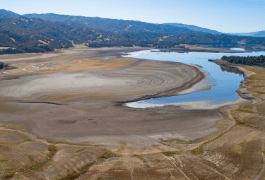
In recent years the southern African county of Namibia has experienced both severe drought and major flooding. Coordinating preparedness, response, and mitigation activates among stakeholders is a complex challenge. Over the last 5 years a group from that NASA Goddard Space Flight Center has been working with locals in Namibia to develop tools to integrate satellite imagery, gage data, crowd-sourced information, and other ancillary data into a web-based decision support system.
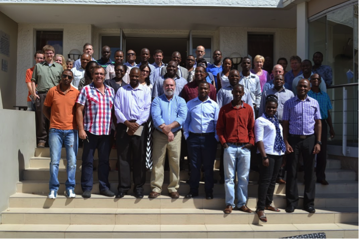
In late February I was fortunate to have been able to travel to Namibia for the Namibia Flood and Drought Risk Management Workshop, organized by the Namibia Hydrological Services within the Ministry of Agriculture, Water, and Forestry in cooperation with NASA. Representatives from Namibia, regional NGOs, and other counties in the area came together to address information needs and to work toward development of future collaborations in the region.
During the workshop, I presented on a cooperative effort between the Kansas Applied Remote Sensing Program (KARS), housed at The University of Kansas, and NASA to integrate modeled flood inundation libraries along the Okavango River in the NASA developed Namibia Flood Dashboard.
In conjunction with the workshop, NASA- sponsored hydrologic modeling training was offered to attendees. This training was centered on a hydrologic model developed at the University of Oklahoma called CREST. The goal of the CREST training was to build capacity within Namibia and other African nations to integrate satellite based precipitation estimation into local decision support systems.
AmericaView Winter Meeting, Washington, DC: Immediately upon return from Namibia. I attended the annual AmericaView winter meeting in DC. AmericaView, sponsored by the USGS, is a nationwide consortium of state-level consortia working to promote remote sensing and geospatial technology research, education, and outreach. The first day of the meeting was held at the USGS headquarters in Reston, Va. The participants received updates on various USGS programs and efforts, land remote sensing and Landsat being important themes. I helped organize a poster session that highlighted the abundant activates of the 39 StateViews that comprise the AmericaView network. Tuesday was busy with the AmericaView business portion of the meeting, followed by two days on Capitol Hill visiting with congressional staffers to offer information on remote sensing and geospatial technology activities occurring at the state level.
Global Flood Working Group, Reading, England: Immediately following the AmericaView meeting I headed back across the pond to Reading for the 4th Global Flood Working Group Workshop in Reading, England. For me this relationship started in the fall of 2011 while my wife was completing her “study abroad” in Lyon, France. During the presentation of a poster and slide presentation at the Tech Fair of the 2nd International Conference of Crisis Mappers I made contact with researcher from the European Commission Joint Research Centre (JRC). A subsequent invitation for be involved with the activities of the Global Flood Working Group had led to many fruitful collaborations with the JRC, NASA, and others.
This year’s workshop held at the European Center for Medium-Range Weather Forecasting (ECMWF). The focus of the workshop was to develop the Global Flood Partners concept that will bring together various operational flood mapping and monitoring tools into a system to support decision making and flood disaster readiness, response, and recovery.
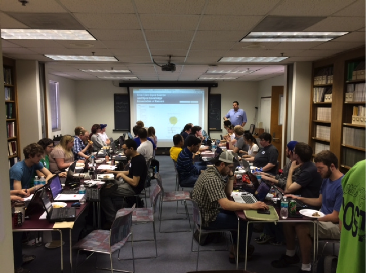
KU MapGive Mapathon, Lawrence, KS: In cooperation with the US State Department and the AmericaView program I coordinated a humanitarian mapping event at the University of Kansas. The focus of our effort was and area in and around Punia in the Democratic Republic of the Congo. MapGive is an initiative coordinated through the US State Department’s Humanitarian Information Unit (HIU), that leverages the United State Government’s NextView license agreement with commercial satellite imagery providers to expose high resolution imagery through a Humanitarian OpenStreetMap Team (H.O.T.) interface to volunteer mappers around the world to that information can be extruded from the imagery (roads, building, streams, etc.) that is then uploaded to the free and open source global OpenStreetMap (OSM) database.
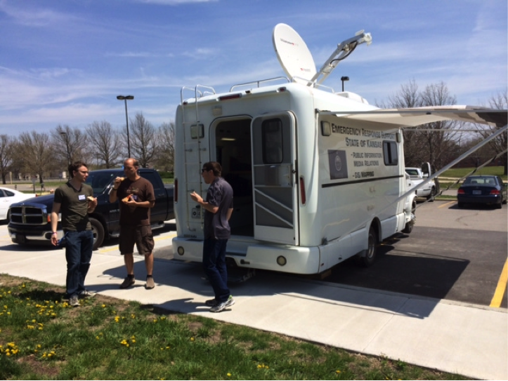
On Saturday, April 19th, from 12-5pm we held a MapGive Mapathon. By all measures it was a great success and we were at capacity with the space that we had available, with about 45 participants. The GIS coordinator, Jesse Smith, from the Kansas Division of Emergency Management, part of the Kansas Adjutant General’s Department, was also on hand with the Kansas GIS disaster response vehicle where several participants spent the day mapping and others toured.
In addition to targeting students in the KU Department of Geography, I also worked with the KU International Student Services program to bring in international students, with the Haskell Indian Nation University, and with our regional OSM – Kansas City Meetup.com group, which bought in excellent OSM expertise. Several people traveled from Kansas City, Topeka, and Manhattan (35, 35, and 85 miles, respectively).
We provided plenty of snacks, pizza, and refreshments for everyone, which was critical for keeping people going for several hours. Josh Campbell, GIS architect for State, and I arranged to have him Skype in during the event, reinforcing the fact that participants were part of something important and larger than the event itself. Josh’s also gave insight into the complexities of setting up MapGive and expounded the humanitarian value of the participants’ efforts.
Summer at the US State Department, Washington, DC: During the summer I will be serving a twelve week appointment within the US State Department’s Humanitarian Information Unit which is in the Bureau of Intelligence and Research. I am excited to have the opportunity to support current HIU activities and initiatives, including MapGive, to learn more about the functioning of the HIU and the State Department, and to interact with a variety of governmental and non-governmental organizations that are involved in humanitarian issues and disaster response.
Destination dissertation: All of these activities support my dissertation work, the focus of which is the development of new methods to leverage synergies between satellite imagery and modeled flood inundation libraries for expedited delivery flood information products and improved near real-time mapping of flood events.